Lists of placenames
In addition to the search, you can use this website to get lists of placenames. There are two places to access these lists: the clickable map of Ireland which you will find on the home page, and the hierarchy links which appear with each place.
Clickable map
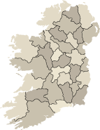
The home page has a map of Ireland in the right column with an outline of the counties. You can click on any county and you will get a listing of the geographical units found in that county in the column on the right of the screen.
When you click on a county, a list of all the sub-units in the county appear. The figures in brackets indicate the number of instances that each sub-unit is found in that particular county. You can click on the various sub-units to get a list of them in the centre column. The ‘Filter by category’ facility on the left can be used to customize the list to display different categories such as towns, civil parishes or rivers in the county. You can click on any of the results on the list to get more information about the place in question.
Hierarchy links
Ireland’s system of geographical administration is organized hierarchically. The county is the highest unit. A county is subdivided into several baronies, a barony into several civil parishes and a parish into several townlands. Electoral divisions are also sometimes used for certain administrative purposes. In addition to these, the database has information about many non-administrative geographical units such as rivers, mountains and islands. All these units are connected to one another in a vast hierarchical network that spans the whole country.
You can navigate through this network by using the links that appear with each place. You will see the links as you look at the textual data of a place. They are located to the right of the textual data. They underline when you move the cursor over them and you can click on them:
- When you are looking at information about a place which is located fairly low in the hierarchy, say a townland, you will get a list displaying the parish, the barony and the county in which the townland is located. You can click on those links to get more details about them.
- When you are looking at information about a place which is fairly high in the hierarchy, say a barony, the right column will contain a list displaying the types of sub-units the barony contains. For example, if you are looking at the barony of Arklow in County Wicklow, the list will tell you that there are 5 towns, 13 parishes, 3 rivers etc. in this barony. You can click on those to see a more detailed list, in the right column, such as a list of all parishes in the barony.